Why robot mapping suddenly matters for everyday autonomy
A few years ago, most robots lived in controlled spaces: taped warehouse lanes, fenced factory cells, or curated demo apartments. Today they’re being asked to do everyday work—moving carts through mixed human traffic, cleaning offices after hours, delivering items across campuses, or assisting in homes where furniture shifts and lighting changes by the minute. In those settings, “just follow a route” breaks quickly.
Mapping is what turns a robot from a remote-controlled gadget into something that can make safe, local decisions: where it can fit, what areas are blocked, and how to recover when a hallway is busier than usual. The shift is partly economic: labor is expensive, and fleets only pay off if they can operate with less babysitting.
But better maps aren’t free. Higher autonomy usually means more sensors, more compute, more data collection, and more edge cases to validate. If the map drifts, the robot can become confident and wrong—often the most dangerous failure mode in a real workplace or home.
What “mapping AI” actually does beyond basic SLAM
Picture a robot that can build a clean floorplan in a quiet office, then gets confused the first time a rolling whiteboard appears or sunlight washes out a hallway. Classic SLAM is good at one core job: estimate the robot’s motion while building a geometric map from sensor measurements. “Mapping AI” usually means adding learned components that make those measurements more usable and the map more actionable.
In practice, AI shows up in perception front-ends and decision layers: learning better visual features for matching across viewpoint and lighting changes, rejecting moving objects so people don’t “burn into” the map, and fusing camera/LiDAR/IMU data more robustly. It can also predict depth from cameras or fill gaps where sensors are noisy, which helps localization stay stable when the scene is partially occluded.
Learned models need training data that resembles the deployment environment, add GPU/accelerator needs, and can fail silently under distribution shifts—like unusual flooring, reflective glass, or seasonal outdoor changes.
From points to meaning: semantic maps that robots can use
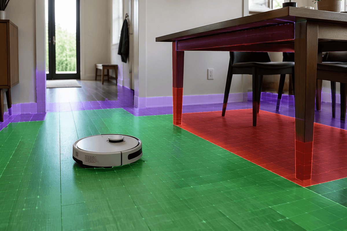
In a warehouse or an office, a purely geometric map can tell a robot where surfaces are, but not what they are. A point cloud that includes a doorway, a glass wall, a pallet, and a person can look like the same kind of “stuff” unless you label it. Semantic mapping adds that missing layer: it tags parts of the world with categories (door, chair, shelf, curb), properties (traversable, fragile, movable), or even simple affordances (can open, can push, should avoid).
That meaning changes behavior. A delivery robot can route around “temporary obstacle” cones differently than a “wall,” or slow down near “human cluster” zones without hard-coding every scenario. In homes, knowing “table” versus “floor” matters for cleaning coverage and for not trying to drive under overhangs it can’t clear.
The semantics depend on perception quality and consistency over time. Labels drift when lighting changes, objects get re-arranged, or the model hasn’t seen a new shelf style. Maintaining a semantic map also costs more compute and data review, and mistakes can be safety-relevant when “clear path” is wrong.
The real-world constraints: lighting, clutter, motion, and change
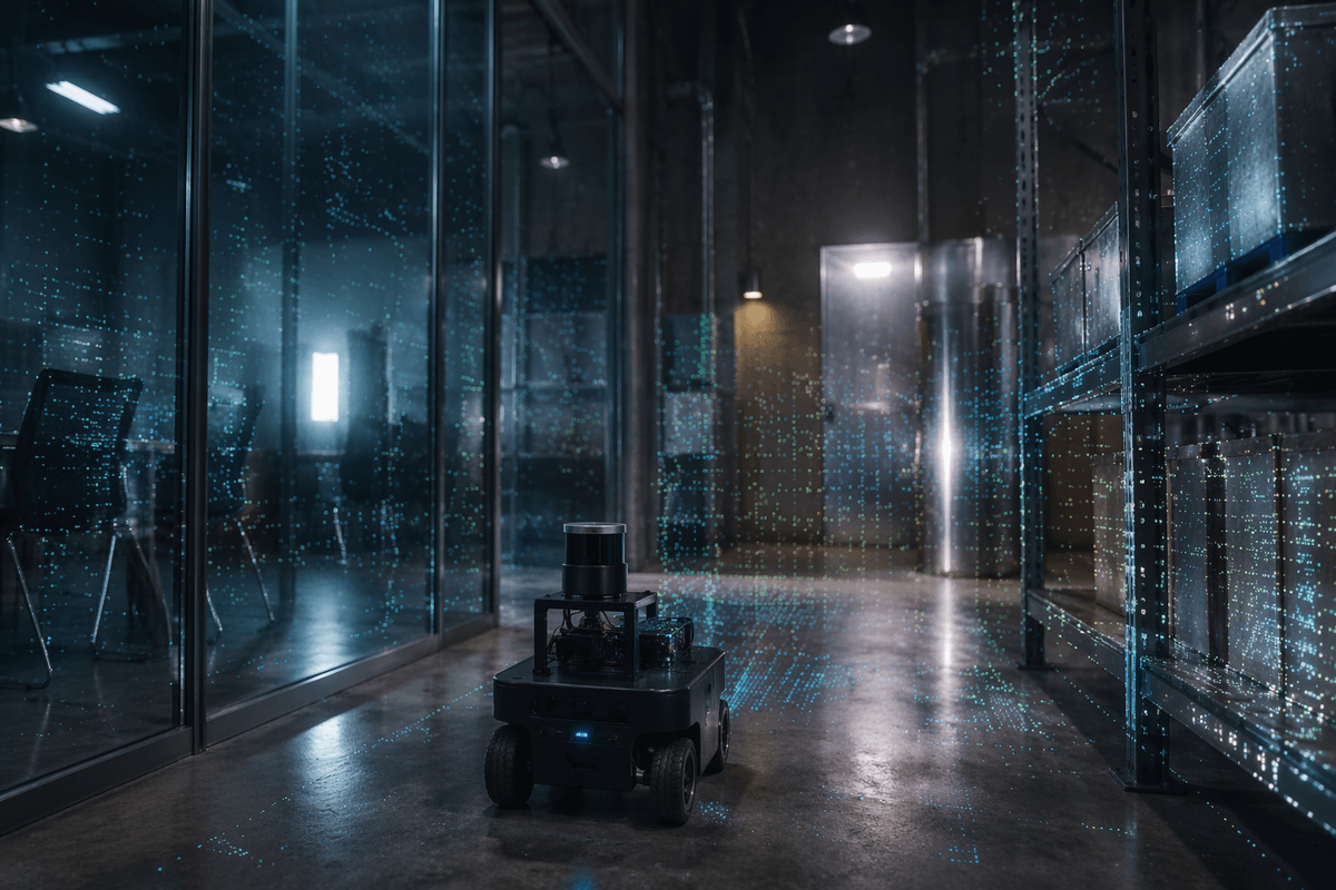
You can see the gap between a good lab map and a usable field map the first time conditions stop cooperating. A hallway at 9 a.m. is a different scene at 3 p.m. when glare hits polished floors, shadows cut across features, and glass reflects the robot’s own sensors. Cameras lose texture in dim corners; LiDAR can get messy around specular surfaces and thin geometry; both struggle when the “reliable landmarks” are posters, plants, or anything that people move.
Clutter and motion create a more fundamental problem: the robot is trying to localize against a world that won’t sit still. If the system can’t separate permanent structure from temporary obstacles, it either bakes people and carts into the map or keeps “forgetting” and re-mapping the same place. That shows up as drift at first—subtle pose error—and then as operational pain: missed docking, scraped corners, or the need to slow down to stay safe.
Change over days and seasons is where costs emerge. Keeping maps fresh may require re-scans, scheduled low-traffic mapping runs, or cloud-to-fleet updates—each one adding downtime, bandwidth, and validation work.
Picking sensors and compute: camera, LiDAR, or both
The sensor choice usually starts with a budget question disguised as a technical one. Cameras are inexpensive and information-dense, so they’re attractive for indoor robots that can tolerate lighting control and occasional relocalization hiccups. The hidden cost is compute: robust visual mapping often needs heavier feature tracking, learned depth, or denoising—and that can mean an edge GPU, more power draw, and more heat management than teams expect.
LiDAR buys geometric reliability. It’s less sensitive to lighting, gives metric depth directly, and tends to localize cleanly in repetitive corridors where cameras struggle. It also has its own corner cases: glass, shiny metal, thin chair legs, and outdoor dust or rain can create sparse or misleading returns. And the bill of materials can jump quickly if you need wide field-of-view coverage or redundancy.
Many production systems land on “both,” plus an IMU: LiDAR stabilizes the map scale, cameras add semantics, and sensor fusion reduces single-point failure—at the price of calibration effort, synchronization bugs, and higher integration test load.
How mapping AI boosts spatial understanding in key applications
Watch how autonomy changes when a map becomes something the robot can query, not just a background asset. In warehouses, mapping AI can keep localization stable through long, similar aisles by fusing LiDAR geometry with visual cues like signage and rack ends, while filtering forklifts and pallets so “busy” areas don’t corrupt the baseline. That steadier pose estimate shows up in practical metrics: fewer failed pick approaches, tighter dock alignment, and less speed throttling triggered by uncertainty.
In offices and hospitals, semantic layers matter more than raw accuracy. Tagging “doorway” versus “glass wall,” or “corridor” versus “waiting area,” lets navigation rules become context-aware without hand-coded maps for every site. The limit is upkeep: layouts change, and keeping semantics current can require periodic re-scans, human review of labels, and more on-robot compute to avoid stale decisions.
Outdoors, mapping AI helps with appearance change—seasonal foliage, construction, shadows—by learning features that survive across conditions and by separating ground from obstacles more reliably. GPS drift and moving crowds still force conservative behavior, so teams often budget for fallback localization and remote support rather than assuming the map will always win.
Implementation pitfalls: data, drift, evaluation, and safety
A pilot often looks solid until the robot meets “normal weirdness”: a new floor finish, a different cart material, holiday decorations, or a firmware update that changes exposure. Learned mapping components are especially sensitive to this, because training data rarely matches the long tail of a deployment site. Teams end up paying for data work they didn’t plan for: collecting runs across lighting conditions, labeling semantics consistently, and curating “bad days” (rain, glare, crowds) instead of only clean logs.
Drift is the slow leak that turns into a flood. Small pose errors accumulate, loop-closures fire late or incorrectly, and the map becomes self-consistent but shifted—so docking fails or keep-out zones get violated. Evaluation has to go beyond offline trajectory error: measure task success (docking, aisle alignment), map stability over weeks, and recovery time after disturbances.
Safety planning needs explicit fallbacks: uncertainty-aware speed limits, conservative obstacle handling, geofenced stop behaviors, and a monitored “can’t localize” mode. Those protections reduce throughput and add testing burden, but they’re cheaper than discovering a confident wrong map in production.
A practical path forward for building smarter robot maps
A practical build usually starts with one environment and one success metric: reliable docking in a warehouse aisle, consistent room coverage in offices, or safe curb-to-door navigation outdoors. Pick sensors to match that constraint, then add semantics only where it changes decisions (doors, keep-out zones, traversable floor) rather than trying to label everything. Treat calibration and time sync as first-class work, because fusion only helps when sensors agree.
Plan for map lifecycle costs: scheduled remapping runs, fleet updates, and a way to detect “map no longer matches” before failures cascade. Validate with week-long runs, not single-day demos, and track operational metrics like intervention rate and recovery time after localization loss. Keep a fallback stack—slow mode, stop-and-call-for-help, or a simpler localization source—because the most expensive bug is a robot that stays confident when it’s wrong.